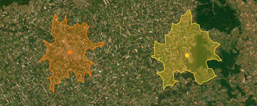
ISOCHRONE
The term ISOCHRONE (from the Greek equal time) in the cartographic sector refers, given a starting point and a time, to the polygon that represents the road area reached from the starting point in the indicated time
ISODISTANCE
The term ISODISTANCE (equal distance) in the cartographic sector refers, given a starting point and a distance, to the polygon which represents the road area reached from the starting point by traveling the indicated distance
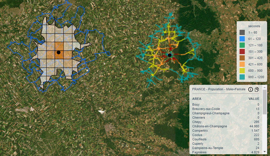
STREET NETWORK
In our system, in addition to providing a polygon, for the isochrones/isodistances, we can also provide the underlying road network divided by time/distance ranges
CATCHMENT AREA
The polygon created by an isochrone/isodistance can be used for the calculation of the contained population, incomes or other data if available
Iso4App
Iso4app for cartographic analysis
We love these beautiful and very useful curves
Register on Iso4App and start giving quality to your work!. If you would like more information or new features, do not hesitate to contact us
Useful links for further information
www.iso4app.com Come calcolare il bacino di utenza Einzugsgebietsberechnung How to calculate the catchment area Análisis del área de influencia Analyse van het verzorgingsgebied Analyse du bassin de clientèle Calcolo di un report basato su Iso4app per il settore del Real Estate